Retevis
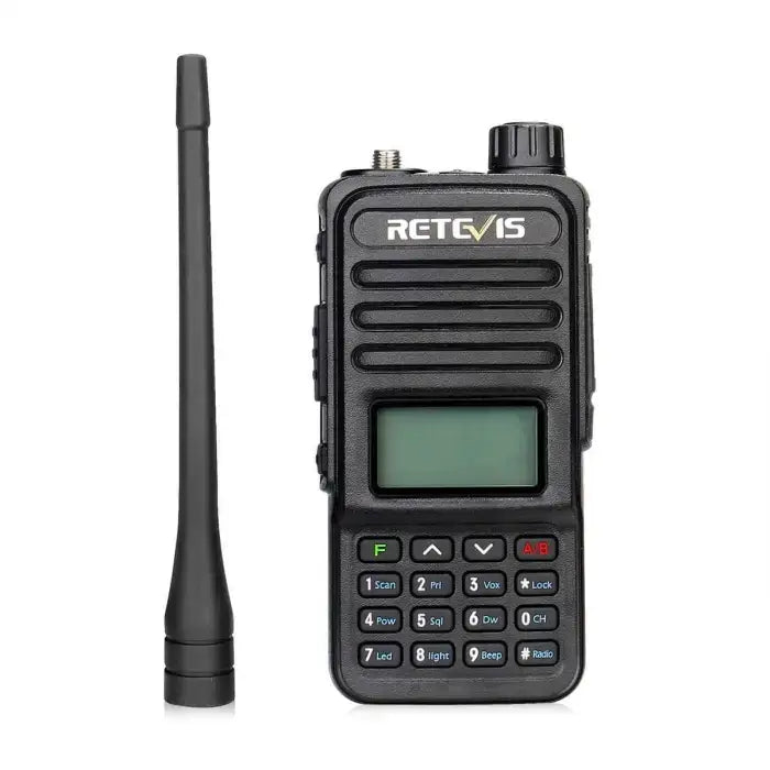
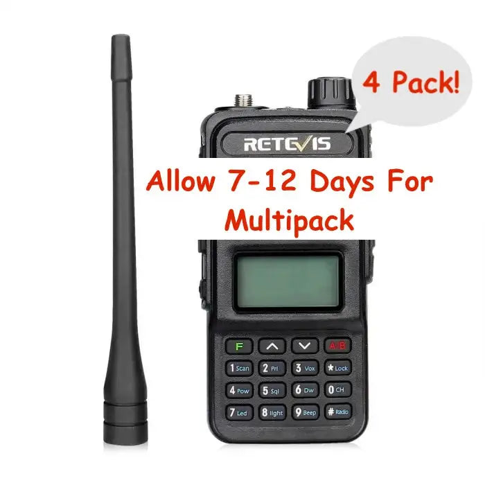
Retevis RT85 N9 Northern Ontario FSR Edition Logging Road Back Country Walkie Talkie Two Way Radio - IC: 23137-RT85
Retevis RT85 N9 Northern Ontario FSR Edition Logging Road Back Country Walkie Talkie Two Way Radio - IC: 23137-RT85
Couldn't load pickup availability


Why Buy?
Why Buy?
Not quite sure if this is right for you? Contact Us for expert advice!
Quick Specs
Quick Specs
K Plug
5W
Scoll down for more information about this item.
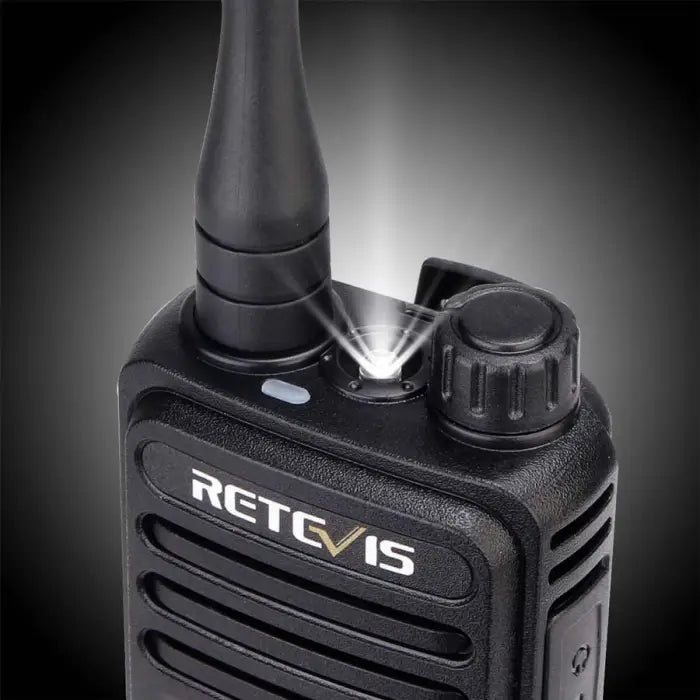
Stay safe on Northern Ontario logging roads and keep in touch with the Retevis RT85 N9 Forest Service Road land mobile radio.
Commercial Frequency:
- VHF: 138.025 - 173.975 (REQUIRES COMPUTER PROGRAMMING)
- UHF: 406.125 - 429.975 (REQUIRES COMPUTER PROGRAMMING)
- UHF: 450.025 - 469.975 (REQUIRES COMPUTER PROGRAMMING)
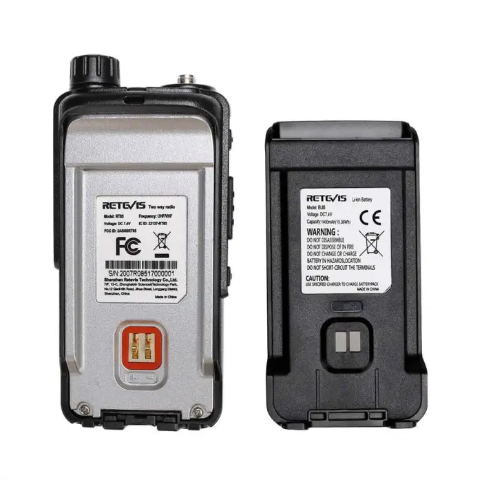
ISED Certified - (IC: 23137-RT85) under RSS-119 for use on commercial land mobile frequencies such as the N9 (Logging Roads, Back Country, Northern Ontario) make this radio a great choice for overlanding comms. A valid ISED Land Mobile License for Appendix N9 is required prior to deployment. The application can be downloaded here (Requires free Adobe reader)
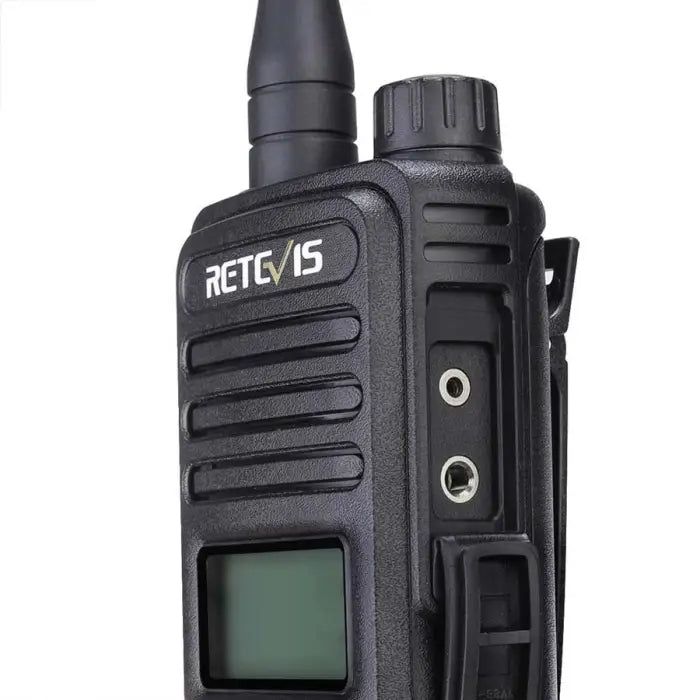
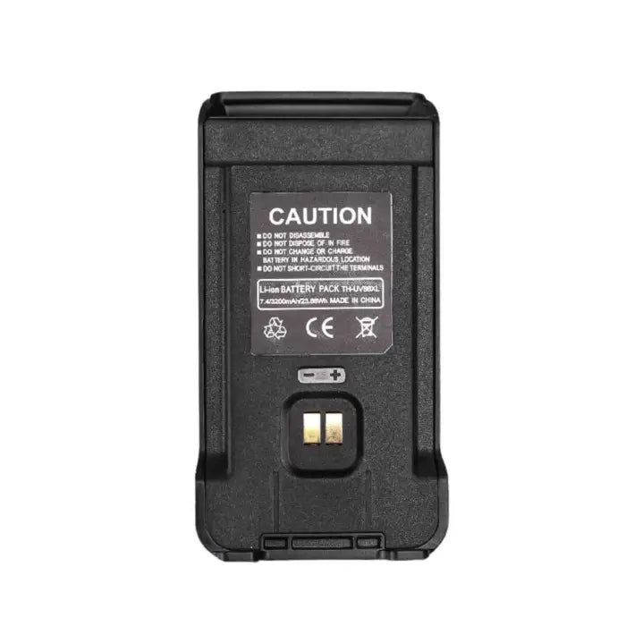
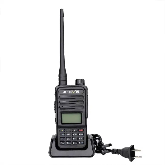
Packed with a standard dual band rubber duck antenna, a Lithium Ion battery pack, and North America 110V desktop charger, this radio is complete right out of the box. Numerous accessories are available to complete your purchase and be ready for your adventures.
Specifications:
General:
- Channel: 128
- Operating Voltage: 7.4VDC
- Operating Temperature (Radio Body): -10 -> +50 C
- Weight (Radio Body): 106g
- Dimensions (Ex Antenna): 116 x 53 x 36mm
Receiver:
- Frequency: 136-174 / 400-480 (REQUIRES COMPUTER PROGRAMMING)
- Sensitivity: <0.2 uV
- Occupied Bandwidth: <16KHz
- Audio Power: >500mW
- Audio Distortion: <10%
- Frequency Stability: 5ppm
- Current Draw: 60mA -> 250mA
- Audio Response (300-3400Hz): +7~-12.5dB
Transmitter:
- Frequency: 136-174 / 400-480 (REQUIRES COMPUTER PROGRAMMING)
- RF Power: 5W (4W UHF)
- Modulation: FM
- Spurious Power: <=15dB
- Modulation Noise: <-40dB
- Modulation Distortion: <5%
- Frequency Stability: 5ppm
- Maximum Frequency Deviation: <+/- 5KHz
- Current Draw: <1600mAh
- Audio Response (300-3400Hz): +6.5~-14dB
- Adjacent Channel Power: <65dB
Box Contents:
- RT85 Radio
- Dual Band Antenna
- Lithium Ion Battery
- Desktop Charger
- Belt Clip
- Instructions
This radio is capable of the following frequencies, making it a good choice for logging roads and back country:
The common logging radio frequencies listed in the table below may be used in the authorized areas and in areas north of 51 degrees latitude in Ontario.
Recreational drivers on the logging roads require reliable vehicle to vehicle communications while on the roadways. For this reason, eight common logging channels (radio frequencies) have been made available for two-way, truck-to-truck radio communications while on certain designated roadways in Northern Ontario. The intent of these channels is to coordinate the safe movement of vehicles on logging roads rather than provide “chat lines” for truck operators. In order to minimize potential radio interference to other radio users, especially essential safety services, use of these channels is restricted to specific geographical areas.
It is very important to understand that use of any channel or frequency outside its authorized area could result in interference to other radio users. Such interference could create dangerous situations and jeopardize lives – including yours. The other radio user, for example, could be an ambulance system dispatching a first response team, or a municipal fire department dispatching a fire truck in a community. Misuse of a radio channel could also cause interference to a heart monitor at a local hospital, or a paging service trying to contact a doctor in order to respond to a sick child.
A valid ISED Land Mobile License for Appendix N9 is required prior to deployment. If you need help please contact us for assistance!
| Channel | Frequency (MHz) | Authorized area of operation |
|---|---|---|
| 1 | 150.290 | The districts of Thunder Bay and Sudbury; part of the District of Algoma, south of the CN Rail line. |
| 2 | 159.270 | East of Nipigon, north of Wawa, Chapleau, Watershed and west of Matheson and Elk Lake. |
| 3 | 163.980 | The districts of Cochrane, Algoma, Sudbury, Timiskaming, Nipissing, Manitoulin and Parry Sound; part of the District of Kenora, north of Red Lake; Highway 17 extending east to Pembroke, north of Highway 60 and all of Algonquin Park. |
| 4 | 165.180 | The districts of Kenora, Thunder Bay and west of Wawa and Hearst, except 50 km radius of Red Lake. |
| 5 | 170.250 | Sudbury, South on Highway 69 to Parry Sound; Sudbury, east on Highway 17 to Pembroke; north of Highway 60, all of Algonquin Park and north of Highway 141. |
| 6 | 170.310 | The districts of Kenora, Rainy River and Thunder Bay. |
| 7 | 171.000 | The districts of Kenora, Rainy River, Thunder Bay and west of Highway 129, Chapleau and Hearst. |
| 8 | 172.065 | The districts of Kenora, Rainy River, Thunder Bay, Algoma and Cochrane; part of the District of Sudbury, north of Cartier and Capreol, except the 50 km radius of Red Lake. |

Description
Stay safe on Northern Ontario logging roads and keep in touch with the Retevis RT85 N9 Forest Service Road land mobile radio.
Commercial Frequency:
- VHF: 138.025 - 173.975 (REQUIRES COMPUTER PROGRAMMING)
- UHF: 406.125 - 429.975 (REQUIRES COMPUTER PROGRAMMING)
- UHF: 450.025 - 469.975 (REQUIRES COMPUTER PROGRAMMING)
ISED Certified - (IC: 23137-RT85) under RSS-119 for use on commercial land mobile frequencies such as the N9 (Logging Roads, Back Country, Northern Ontario) make this radio a great choice for overlanding comms. A valid ISED Land Mobile License for Appendix N9 is required prior to deployment. The application can be downloaded here (Requires free Adobe reader)
Packed with a standard dual band rubber duck antenna, a Lithium Ion battery pack, and North America 110V desktop charger, this radio is complete right out of the box. Numerous accessories are available to complete your purchase and be ready for your adventures.
Specifications:
General:
- Channel: 128
- Operating Voltage: 7.4VDC
- Operating Temperature (Radio Body): -10 -> +50 C
- Weight (Radio Body): 106g
- Dimensions (Ex Antenna): 116 x 53 x 36mm
Receiver:
- Frequency: 136-174 / 400-480 (REQUIRES COMPUTER PROGRAMMING)
- Sensitivity: <0.2 uV
- Occupied Bandwidth: <16KHz
- Audio Power: >500mW
- Audio Distortion: <10%
- Frequency Stability: 5ppm
- Current Draw: 60mA -> 250mA
- Audio Response (300-3400Hz): +7~-12.5dB
Transmitter:
- Frequency: 136-174 / 400-480 (REQUIRES COMPUTER PROGRAMMING)
- RF Power: 5W (4W UHF)
- Modulation: FM
- Spurious Power: <=15dB
- Modulation Noise: <-40dB
- Modulation Distortion: <5%
- Frequency Stability: 5ppm
- Maximum Frequency Deviation: <+/- 5KHz
- Current Draw: <1600mAh
- Audio Response (300-3400Hz): +6.5~-14dB
- Adjacent Channel Power: <65dB
Box Contents:
- RT85 Radio
- Dual Band Antenna
- Lithium Ion Battery
- Desktop Charger
- Belt Clip
- Instructions
This radio is capable of the following frequencies, making it a good choice for logging roads and back country:
The common logging radio frequencies listed in the table below may be used in the authorized areas and in areas north of 51 degrees latitude in Ontario.
Recreational drivers on the logging roads require reliable vehicle to vehicle communications while on the roadways. For this reason, eight common logging channels (radio frequencies) have been made available for two-way, truck-to-truck radio communications while on certain designated roadways in Northern Ontario. The intent of these channels is to coordinate the safe movement of vehicles on logging roads rather than provide “chat lines” for truck operators. In order to minimize potential radio interference to other radio users, especially essential safety services, use of these channels is restricted to specific geographical areas.
It is very important to understand that use of any channel or frequency outside its authorized area could result in interference to other radio users. Such interference could create dangerous situations and jeopardize lives – including yours. The other radio user, for example, could be an ambulance system dispatching a first response team, or a municipal fire department dispatching a fire truck in a community. Misuse of a radio channel could also cause interference to a heart monitor at a local hospital, or a paging service trying to contact a doctor in order to respond to a sick child.
A valid ISED Land Mobile License for Appendix N9 is required prior to deployment. If you need help please contact us for assistance!
| Channel | Frequency (MHz) | Authorized area of operation |
|---|---|---|
| 1 | 150.290 | The districts of Thunder Bay and Sudbury; part of the District of Algoma, south of the CN Rail line. |
| 2 | 159.270 | East of Nipigon, north of Wawa, Chapleau, Watershed and west of Matheson and Elk Lake. |
| 3 | 163.980 | The districts of Cochrane, Algoma, Sudbury, Timiskaming, Nipissing, Manitoulin and Parry Sound; part of the District of Kenora, north of Red Lake; Highway 17 extending east to Pembroke, north of Highway 60 and all of Algonquin Park. |
| 4 | 165.180 | The districts of Kenora, Thunder Bay and west of Wawa and Hearst, except 50 km radius of Red Lake. |
| 5 | 170.250 | Sudbury, South on Highway 69 to Parry Sound; Sudbury, east on Highway 17 to Pembroke; north of Highway 60, all of Algonquin Park and north of Highway 141. |
| 6 | 170.310 | The districts of Kenora, Rainy River and Thunder Bay. |
| 7 | 171.000 | The districts of Kenora, Rainy River, Thunder Bay and west of Highway 129, Chapleau and Hearst. |
| 8 | 172.065 | The districts of Kenora, Rainy River, Thunder Bay, Algoma and Cochrane; part of the District of Sudbury, north of Cartier and Capreol, except the 50 km radius of Red Lake. |
Purchase With Confidence
Questions & Answers
Have a Question?
Be the first to ask a question about this.


